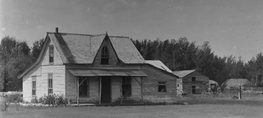
Hamilton
Hamilton stood at the top of the Moissouri Trail as it rose from the Pembina Valley.
Agricultural Topics
A research paper published by Manitoba Culture, Heritage and Recreation, Historic Resources Branch.
PMA_2024_077915
Arts & Crafts

Book Store
.jpg)
This monograph is intended to highlight the museum's history, its relationship to the other communities on the line, and pointing out some of the anecdotes from along the line. It was published by the Pembina Manitou Archive and the Boundary Trail National Heritage Region as part of the Partnerships with Museums 2021 project.
Financial support was provided by the Government of Manitoba.
It is for sale from the PMA by contacting pembinamanitouarchive@gmail.com.
Price $25
Shipping and Handling $15.
PMA_2021_053636
Business & Public Affairs
.jpg)
Settlement period photos and documents from the family of Francis & Elizabeth Windsor - McKenzie District in Southern Manitoba.
PMA_2018_045628
Cemetery Maps/Lists
The McKenzie Cemetery was deconstructed to clear the land for fieldwork, the stones bulldozed. Later some stones were reclaimed and set along the headland near the cemetery site.
PMA_2018_045629
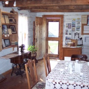
Community Histories
A collection of photos from 1890 to 1954 taken and collected by Ida Handford Conner which chronicle their lives in the Hamilton/Snowflake district and at Conner Bridge in Southern Manitoba.
PMA_2018_044491
Letters
.JPG)
Letters written by Tennant and published in the Emerson International.
PMA_2025_079978
Manitoba Histories
Kroeker's photographic study of the reenactment of the Boundary Commission's journey and the celebration of the NWMP journey west.
PMA_2020_046814
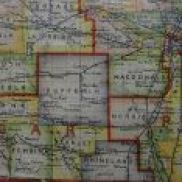
Maps
.JPG)
A listing by quarter section of the homesteaders of 2-9W in Southern Manitoba.
PMA_2018_045627
Memoirs & Memories
.JPG)
A memoir of life in the McKenzie District of Southern Manitoba.
PMA_2018_045625
Museums
This monograph is intended to highlight the museum's history, its relationship to the other communities on the line, and pointing out some of the anecdotes from along the line. It was published by the Pembina Manitou Archive and the Boundary Trail National Heritage Region as part of the Partnerships with Museums 2021 project.
Financial support was provided by the Government of Manitoba.
It is for sale from the PMA by contacting pembinamanitouarchive@gmail.com.
Price $25
Shipping and Handling $15.
PMA_2021_053636
Photos & Art Work
.JPG)
A collection of photos from 1890 to 1954 taken and collected by Ida Handford Conner which chronicle their lives in the Hamilton/Snowflake district and at Conner Bridge in Southern Manitoba.
PMA_2018_044491
Regional Rail Lines
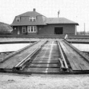
This monograph is intended to highlight the museum's history, its relationship to the other communities on the line, and pointing out some of the anecdotes from along the line. It was published by the Pembina Manitou Archive and the Boundary Trail National Heritage Region as part of the Partnerships with Museums 2021 project.
Financial support was provided by the Government of Manitoba.
It is for sale from the PMA by contacting pembinamanitouarchive@gmail.com.
Price $25
Shipping and Handling $15.
PMA_2021_053636
Veterans' Experience & War Effort
.jpg)
Instructions for military behaviour and rules of conduct.
PMA_2025_080004
