Browse John Warkentin
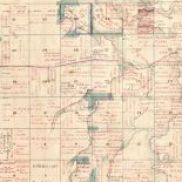
Published by the Manitoba Historical Society in 1970 and edited by John Warkentin and Richard Ruggles, the Historical Atlas of Manitoba contains maps of Manitoba dated 1612 to 1969.
PMA_2014_021782
Published by the Manitoba Historical Society in 1970 and edited by John Warkentin and Richard Ruggles, the Historical Atlas of Manitoba contains maps of Manitoba dated 1612 to 1969.
PMA_2014_021783
Published by the Manitoba Historical Society in 1970 and edited by John Warkentin and Richard Ruggles, the Historical Atlas of Manitoba contains maps of Manitoba dated 1612 to 1969.
PMA_2014_021785
Published by the Manitoba Historical Society in 1970 and edited by John Warkentin and Richard Ruggles, the Historical Atlas of Manitoba contains maps of Manitoba dated 1612 to 1969.
PMA_2014_021786
Published by the Manitoba Historical Society in 1970 and edited by John Warkentin and Richard Ruggles, the Historical Atlas of Manitoba contains maps of Manitoba dated 1612 to 1969.
PMA_2014_021787
Published by the Manitoba Historical Society in 1970 and edited by John Warkentin and Richard Ruggles, the Historical Atlas of Manitoba contains maps of Manitoba dated 1612 to 1969.
PMA_2014_021788
Published by the Manitoba Historical Society in 1970 and edited by John Warkentin and Richard Ruggles, the Historical Atlas of Manitoba contains maps of Manitoba dated 1612 to 1969.
PMA_2014_021789
Published by the Manitoba Historical Society in 1970 and edited by John Warkentin and Richard Ruggles, the Historical Atlas of Manitoba contains maps of Manitoba dated 1612 to 1969.
PMA_2014_021790
Published by the Manitoba Historical Society in 1970 and edited by John Warkentin and Richard Ruggles, the Historical Atlas of Manitoba contains maps of Manitoba dated 1612 to 1969.
PMA_2014_021791
Published by the Manitoba Historical Society in 1970 and edited by John Warkentin and Richard Ruggles, the Historical Atlas of Manitoba contains maps of Manitoba dated 1612 to 1969.
PMA_2014_021792