Browse Pembina Municipality
.jpg)
A promotional booklet outlining the business and cultural opportunities available in the Pembina Manitou area circa 2007. This document was prepared by the Pembina Manitou Community Development Corporation.
PMA_2013_018203
.JPG)
Published in 2000, this map shows all of the rural schools in the Pembina Municipality.
PMA_2013_015117
Published in 2000, this map shows all of the rural schools in the Pembina Municipality.
PMA_2013_015118
Published in 2000, this map shows all of the rural schools in the Pembina Municipality.
PMA_2013_015116
Published in 2000, this map shows all of the rural schools in the Pembina Municipality.
PMA_2013_015115
Published in 2000, this map shows all of the rural schools in the Pembina Municipality.
PMA_2013_015120
Published in 2000, this map shows all of the rural schools in the Pembina Municipality.
PMA_2013_015119
Published in 2000, this map shows all of the rural schools in the Pembina Municipality.
PMA_2013_015121
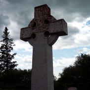
Serving the Pembina Crossing district since the 1880's, this churchyard cemetery surrounds the St Luke's Anglican Church.
PMA_2013_019659
This list of those buried in St. Luke's Pembina Crossing Cemetery is current to January 2019.
PMA_2016_037625