Browse Pembina Manitou Archive
.jpg)
Prairie History
PMA_2026_085576
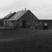
A history of the early years of the Manitoba Mennonite East Reserve.
PMA_2026_086988
A early history of the Manitoba Mennonite East Reserve.
PMA_2026_086989
.JPG)
Published by the Manitoba Historical Society in 1970 and edited by John Warkentin and Richard Ruggles, the Historical Atlas of Manitoba contains maps of Manitoba dated 1612 to 1969.
Listed page by page to preserve image density.
PMA_2024_075282
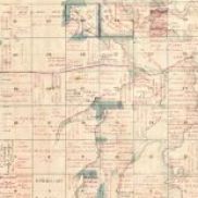
Published by the Manitoba Historical Society in 1970 and edited by John Warkentin and Richard Ruggles, the Historical Atlas of Manitoba contains maps of Manitoba dated 1612 to 1969.
Listed page by page to preserve image density.
PMA_2024_075283
Published by the Manitoba Historical Society in 1970 and edited by John Warkentin and Richard Ruggles, the Historical Atlas of Manitoba contains maps of Manitoba dated 1612 to 1969.
Listed page by page to preserve image density.
PMA_2024_075284
Published by the Manitoba Historical Society in 1970 and edited by John Warkentin and Richard Ruggles, the Historical Atlas of Manitoba contains maps of Manitoba dated 1612 to 1969.
Listed page by page to preserve image density.
PMA_2024_075285
Published by the Manitoba Historical Society in 1970 and edited by John Warkentin and Richard Ruggles, the Historical Atlas of Manitoba contains maps of Manitoba dated 1612 to 1969.
Listed page by page to preserve image density.
PMA_2024_075286
Published by the Manitoba Historical Society in 1970 and edited by John Warkentin and Richard Ruggles, the Historical Atlas of Manitoba contains maps of Manitoba dated 1612 to 1969.
Listed page by page to preserve image density.
PMA_2024_075287
Published by the Manitoba Historical Society in 1970 and edited by John Warkentin and Richard Ruggles, the Historical Atlas of Manitoba contains maps of Manitoba dated 1612 to 1969.
Listed page by page to preserve image density.
PMA_2024_075288